

Für diesen Cache gibt es noch keine Statistik.
 Bitte logge dich ein, um die Koordinaten zu sehen.
 0x gefunden
  0x nicht gefunden
  0 Bemerkungen
  0 Beobachter
  Bewertet als: n/a


 Cacheattribute


 Beschreibung
EN
Beschreibung
EN
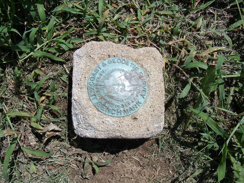
DESIGNATION - J 58
PID - GA0580
STATE/COUNTY- TN/CARTER
USGS QUAD - ELIZABETHTON (1968)
STATION DESCRIPTION
DESCRIBED BY NATIONAL GEODETIC SURVEY 1934
AT ELIZABETHTON.
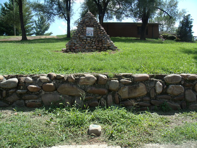
OPPOSITE CENTER OF NORTH SIDE OF ELIZABETHTON HIGH SCHOOL, 2 FEET NORTH OF STONE FENCE, 6 INCHES SOUTH OF WALK.
Benchmark is located about two feet from the edge of the side walk along E Doe Ave, and in front of the Daniel Boone Wilderness Trail Marker number 60 in Elizabethton, Tennessee.
As with any Virtual geocache or Benchmarking, photo proof of visit is required.
 Logeinträge:
0x
0x
0x
Logeinträge:
0x
0x
0x


